Ausmalbilder einfach und kostenlos als pdf herunterladen
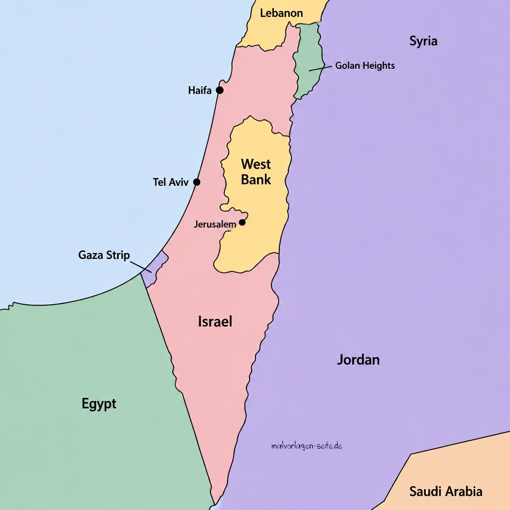
Map of Israel
On this page, you can download a free political map of Israel that clearly illustrates the country’s main borders and neighboring countries. The map has been designed to provide an easy overview of Israel’s location within the region. Featuring the surrounding countries, this map gives a better understanding of the general political landscape in this part of the world. Neighboring countries are labeled to offer clear context regarding Israel’s regional relations. With only the essential elements included, the map keeps information accessible and uncomplicated. It does not delve into historical or political disputes and focuses solely on geographical facts. Downloading the map is completely free and does not require registration.
Map of Israel
The digital file is provided in high resolution for optimal clarity when printed or viewed on screen. Teachers and students may use this resource for school projects or research. Travelers might find it helpful when planning a trip or learning more about the area. The map is also suitable for personal studies or presentations. You can share the map with friends or colleagues who are interested in the Middle East. No additional software is needed to access or print the map. Feel free to use the map as a quick reference guide. The download link is safe and straightforward to use. By clicking the map it opens as jpg-file:
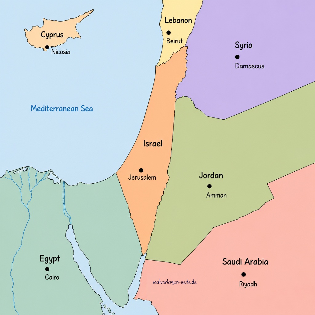
Political Map of Israel
Political Map of Israel
Please respect the usage terms provided on this page. This map is meant for informational and educational purposes only. It provides a simple visual overview, hoping to support broader understanding without promoting any political opinions.